Smart Cam Tech
To start the UAV Photo application, locate the UAVPhoto icon in the installed programs.


When you start the application, you will see options that will change depending on whether you wish to use both cameras or just the main back camera.
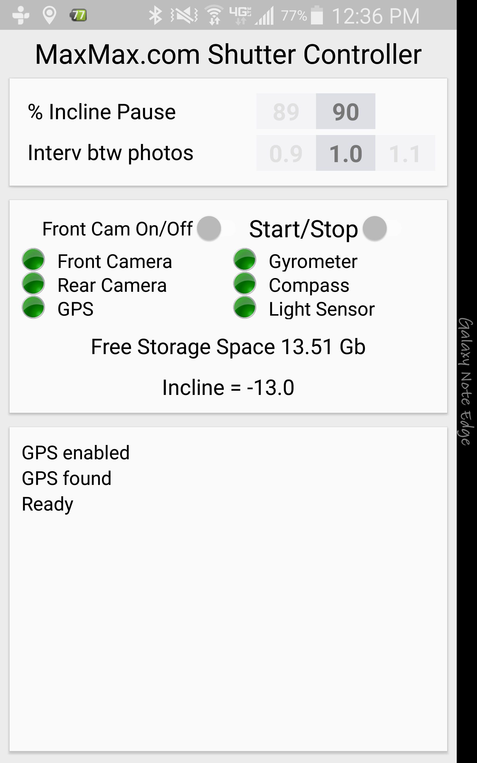
If the Front Camera is turned off, then you will see a screen like the one below. The 'Interv btw photos' is the interval in seconds that you wish for the back camera.
If you have the front camera turned on, then you will see an additional timing option for the delay between taking pictures with the rear camera and front camera. The 'Intev btw cameras' is the time in seconds between taking a rear picture and front picture. If you set the timing too quickly, then the camera may not have enough time to take pictures.
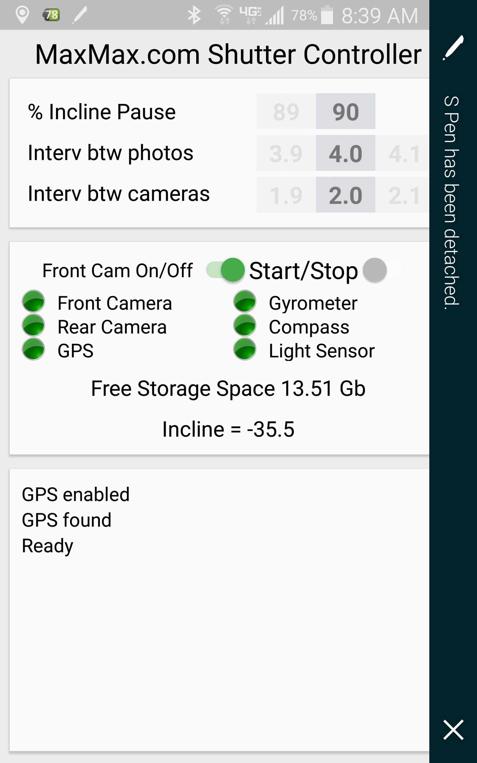
The Incline Pause function allows you to set the amount of incline for the camera to stop taking pictures. This can be used to temporarily stop the camera from taking pictures when the camera is flying an a UAV and the UAV makes a banked turn. Setting the Incline to zero will disable this function.
When you press the Start/Stop button, the camera will start taking pictures until you either stop the program using the Start/Stop button or the preset incline pause occurs. The green color dots will flash orange when the the particular sensor is being accessed.
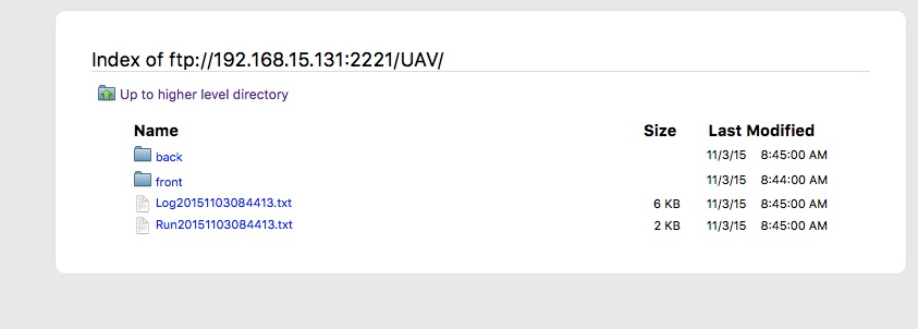
After a run is finished, the associated data files can be found in the UAV directory. In the UAV directory there are two subdirectories label Front and Back which contain the images for the run. There is also a Log file generated that contains information about the run and whether any errors have occurred. The Run file contains information about each picture taken.
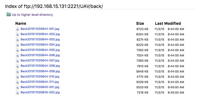
Here you can see the pictures in the Back directory. Each picture and each run will have a unique name that is structured with the following format:
Back + Year + Month + Day + Time + Picture Number in the run. The time is the time of the start of the run.
The Log file is a comma delimited file with detailed information about each front and rear picture.
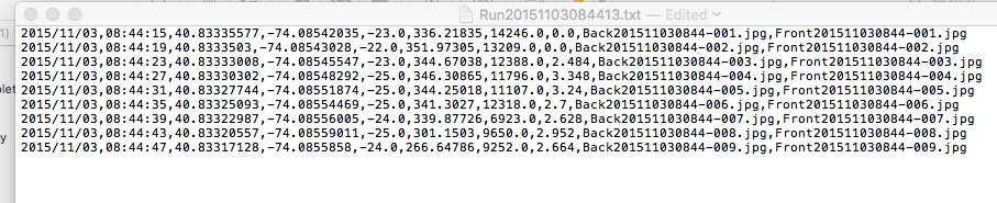
The Log file format is:
- Date of Run Start
- Time of Picture
- GPS Longitude
- GPS Latitude
- GPS Altitude
- Compass Direction
- Ambient Light Sensor (Light above the camera) in SI lux units
- Speed in km/hr
- Back Camera File Name
- Front Camera File Name
Note of GPS altitude: GPS does not report the height above the mean sea level, rather the GPS system compares the height to the WGS84 reference ellipsoid which may be above or below the actual sea level. In different parts of the earth it can be off by more than 200 meters (depending on the mass distribution of Earth). For example the geoid's surface around Florida is above the mean sea level by a good 30-40 meters, which means that standing on the shore would show you -30m as altitude. This is normal, and not an error, and caused by the fact that the altitude is relative to an artificial reference surface and not to the sea level.